|
|
|
|
|
|
| April 19, 2024 |
|
Finale set in stormy series 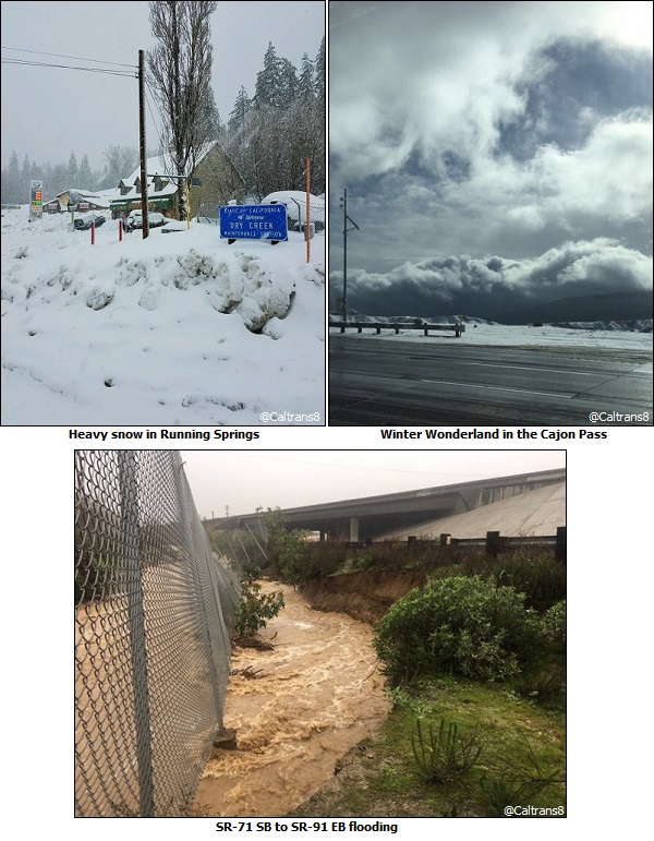
INLAND EMPIRE - (INT) - The curtain is about to go up and the tension is rising. All the players are in place for a performance that will cap three successive acts of stormy mid-winter weather.
High wind warnings, flash flood watches and winter storm warnings have been issued as the third Pacific storm in four days is about to strike. The consequences could be far-ranging. · Flash Flooding and River Flooding possible. o Possible flooding of the Whitewater river basin through the Coachella Valley. o Debris flows/mudslides from recent burn scars possible (Blue Cut and Silverado burn areas in particular). · Another round of strong winds could topple more trees, power poles/lines, cause structural damage and be dangerous for high profile vehicles. · Higher snow levels on Sunday (up to 7500 feet) will result in heavy rain falling on top of snow, resulting in increased run-off and a higher risk of flooding. · Very heavy snow will occur again above 6000 foot elevation on Monday after colder air moves in, causing dangerous travel in the mountains. · Accumulating snow down to the 3500-4000 foot level on Monday could impact the Cajon Pass (I-15) and I-8 in San Diego County. · Continued heavily saturated grounds will likely result in more diseased/drought stricken trees falling. · Thunderstorms possible for all areas on Monday, including at the beaches and coastal waters. Thunderstorms could produce strong and damaging downdraft winds. · Dense fog in the mountains. · Gale-force winds and large seas (>10 feet) will continue to bring dangerous sea conditions for boaters. Waterspouts could also occur. · Although surf will lower a bit Sunday through Tuesday likely below damaging levels... high surf, dangerous swimming conditions, powerful rip currents, waves overtopping jetties and beach erosion will continue. Forecast Precipitation Totals: · Coast/Valleys: 2-3 inches · Mountains: 4-7 inches, local 9 inches · High Deserts: 0.5-1.5 inches · Lower Deserts: 0.25-1.5 inches Forecast Snow Totals Sunday through Monday: · Snow Levels: Rising to 7500 feet Sunday, lowering quickly to 6000 feet late Sunday evening, then down to 4500 feet Monday morning and finally down to 3500-4000 feet Monday afternoon. · At Elevations 3500 feet to 4000 feet: Trace to 2 inches · At Elevations 4500 feet to 5000 feet: 6 to 12 inches · At Elevations 5500 feet to 6000 feet: 10 to 18 inches · At Elevations 6500 feet to 7000 feet: 1 to 2 feet · At Elevations greater than 7000 feet: 2 to 3 feet Timing: · Precipitation: Showers increasing Sunday with moderate to heavy precipitation moving into the forecast area mid-to-late Sunday afternoon through late Sunday night. Moderate to locally heavy showers then continue through the day Monday, with mainly light showers for Monday night into Tuesday. · Strongest Winds: Late Sunday morning through Monday morning. Storms Thursday and Friday lead off the 3-part series. Looking ahead, fair weather high pressure should end the rain by Wednesday and return the sunshine, boosting temperatures back to normal. 24 hour rainfall ending at 9pm Friday: Riverside .68 Moreno Valley l.00 San Bernardino 1.48 Ontario 1.44 Lake Elsinore 1.96 Lytle Creek 2.86 Palm Springs .67 Big Bear 10 inches new snow Story Date: January 24, 2017
|
      |