|
|
|
|
|
|
| April 20, 2024 |
|
Spring jet stream pattern baffles forecasters 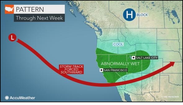
SAN FRANCISCO California weather watchers have got plenty to talk about.
Weather geeks and professional forecasters are sharing amazement and awe over an anomalously strong storm sweeping California with rain and snow this month at a time when the state usually begins to dry out. "Our state weather has gone insane," wrote one San Jose-based Twitter user. "That's a yikes from me dawg," tweeted Jim Tang, an SF-based software developer and storm chaser, who also shared a satellite image of a storm draped over the West. There's a lot of insider talk about the jet stream that many are saying isn't behaving as usual for this time of year. "A series of storms will take aim at #NorCal as a strong Pacific jet stream extends toward the West Coast - a pattern more typical of mid-winter than May," shared Daniel Alrick, a meteorologist with the Bay Area Air Quality Management District in San Francisco. "Ongoing changes in the jet stream pattern continue to affect weather in North America," chimed in Will Hatheway, whose twitter handle is @MeteorologistWH. "The current pattern is more typical of April than mid-May, when a straighter west-to-east flow is usually seen." Meteorologists are also throwing around a lot of numbers, making estimates on just how much rain and snow might fall before the month is over and whether any records will be broken. Story Date: May 28, 2019
|
      |